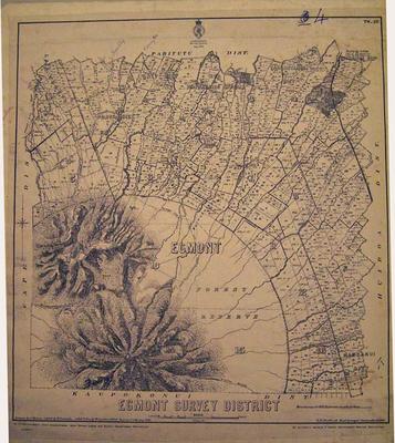
Egmont Survey District 1920
Production date
1920
Description
Cadastral map of the Egmont Survey District. Drawn by J. Homan with additions by W. Deverell and W. Gordon 1903. Revised by T. V. MacKay 1920. Lands and Survey, Wellington. 36cm x 39 cm. [Note ARC2007-176 is pasted to the other side.]
See full details
Object detail
Part 1
Date: 1920
Scale: 80 chain to 1 inch ( mile to the inch)
Size: 26cm. W x 39cm. H
Surveyor: J Homan.
Additions W Deverell, W Gordon (1903)
Revision: T V MacKay 1920
Publisher: Lands and Survey Department, Wellington.
Notes: Paper mounted on card.

Public comments
Be the first to comment on this object record.