New Plymouth Sections
Production date
Circa 1860-1950
Description
A collection of documents and books (73) created by Fred Butler on transactions of land sections in the urban area of New Plymouth.
Information has been taken from the District of New Plymouth Allotment Books. Each town section is identified and information on Crown Grants, conveyances, mortgages and transfers and dates, names and occupations of those involved in transactions is noted. The information covers the period c.1860-1950.
See also individual 'New Plymouth Street' volumes in the Butler Scrapbook Collection.
See full details
Object detail
Box 1
New Plymouth Sections. Arranged in box by section number. Includes index.
Includes New Plymouth section numbers:
“G” allotment New Plymouth
“Z” allotment New Plymouth
57
90
110
593-597
634
635
642
645
647
649
650
655
662
676
710
734
748
749
768
778
859
880
881
882
883
884, 883 and 899
885
886
887
889
894
895
896
897
898
900
901
910
922
939
952
1438 and 1439
1440
1441
1449
1450
1451
1452
1460 and 1461
1464 and 1465
1466
1467
1468
1477
1487 and 1461
Bound book:
New Plymouth section 2326-2377, limited information for most.
Detail plans of:
Cemetery Reserve, Fort Niger, Kawau Reserve, Marsland Hill Domain, Mt Eliot Reserve, Mount Byron Domain, Mount McCormick, Pukenui Nature Reserve No 14, Pure-Warangi, Railway, St Germain’s Square and St Michaels Square.
Unbound book:
New Plymouth section numbers 905, 906 and 905A.
Index:
New Plymouth section numbers 636, 637, 638, 639, 630, 631, 632, 633.
Box 2
1. New Plymouth Sections. No’s 1-151.
2. New Plymouth Sections. No’s 152-300.
3. New Plymouth Sections. No’s 300-450.
4. New Plymouth Sections. No’s 451-600.
5. New Plymouth Sections. No’s 601-750.
6. New Plymouth Sections. No’s 751-900.
7. New Plymouth Sections. No’s 901-1050.
8. New Plymouth Sections. No’s 1051-1200.
9. New Plymouth Sections. No’s 1201-1329.
10. New Plymouth Sections. No’s 1330-1480.
Box 3
11. New Plymouth Sections. No’s 1481-1630.
12. New Plymouth Sections. No’s 1631-1760.
13. New Plymouth Sections. No’s 1761-1925.
14. New Plymouth Sections. No’s 1926-2090.
15. New Plymouth Sections. No’s 2091-2246.
16. New Plymouth Sections. No’s 2247-2325.
17. New Plymouth Sections. No’s 2326-2377.
18. Untitled [New Plymouth Sections. No’s 650-939.]
19. Untitled [New Plymouth Sections. No’s 1438-1461.]
20. New Plymouth Devon Street south side. Going west from near Morley Street.
Box 4
21. New Plymouth Devon Street north side. Going west, near Weymouth Street.
22. New Plymouth Devon Street south side. Going west, Currie Street to near Morley Street.
23. New Plymouth Devon Street north side. Going east, Currie Street to Gover Street.
24. New Plymouth Devon Street north side. Going west, Currie Street to near Weymouth Street.
25. New Plymouth Devon Street north side. Strandon to Waiwakaiho River.
26. New Plymouth Devon Street north side. Gover Street to Strandon.
27. New Plymouth Devon Street south side. Going east, Currie to Gover Streets.
28. New Plymouth Devon Street south side. Going east, Gover to Watson Streets.
Box 5
29. New Plymouth Devon Street south side. Going east, Watson to Bridle Streets.
30. New Plymouth Devon Road south side. Henwood Road -.
31. New Plymouth Devon Road north side. Waiwakaiho River to Bell Block (Nugent Street).
32. New Plymouth Devon Road south side. Bridle Street to Henwood Road.
33. New Plymouth Devon Road going east. Bell Block (Nugent Street) -.
34. New Plymouth Devon Road north side. Airodrome -.
35. New Plymouth Devon Road south side. Airodrome -.
36. New Plymouth, Robe Street.
37. Mangorei “Meeting of the Waters” New Plymouth.
38. New Plymouth Gill Street. South side, - Hobson Street.
Box 6
39. New Plymouth Gill Street, north side.
40. New Plymouth Gill Street, south side to Hobson Street.
41. New Plymouth Courtenay Street, north side to Hobson Street.
42. New Plymouth Courtenay Street north side. Hobson Street -.
43. New Plymouth Courtenay Street south side.
44. New Plymouth Currie Street west side.
45. New Plymouth Currie Street east side.
46. New Plymouth Liardet Street west side.
Box 7
47. New Plymouth Liardet Street east side.
48. New Plymouth James Lane and Huatoki Lane.
49. New Plymouth Egmont Street and Rangi Street
50. New Plymouth Powderham Street north side.
51. New Plymouth Powderham Street south side.
52. New Plymouth Vivian Street north side.
53. New Plymouth Vivian Street south side.
54. New Plymouth Queen Street.
55. Mountain Road and Kairau Road.
56. New Plymouth Egmont Road.
Box 8
57. New Plymouth St Aubyn Street south side to Morley Street.
58. New Plymouth St Aubyn Street north side to -.
59. New Plymouth St Aubyn Street south side Morley Street -.
60. New Plymouth Young Street.
61. New Plymouth Ariki Street.
62. New Plymouth King Street.
63. New Plymouth Gover Street east side.
64. New Plymouth Gover Street west side.
65. New Plymouth Carrington Road west side.
66. New Plymouth Carrington Road east side.
Box 9
67. Omata Village sections.
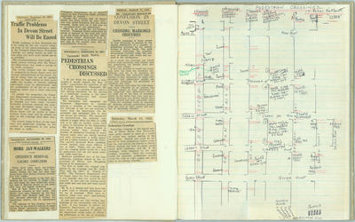
68. New Plymouth. [Including plan of Storehouse Reserve, notes on footpaths and sidewalks in New Plymouth, plan of Gill Street, plan of bike racks in New Plymouth, plan of pedestrian crossings n New Plymouth].
69. Untitled [Devon Street going east in front of book. Devon Street going west in back of book.]
70. New Plymouth. Brougham Street, east side.
71. New Plymouth. Brougham Street, west side.

Public comments
Be the first to comment on this object record.